There’s nothing like enjoying the freedom of the open road. With no one setting your itinerary except yourself, you can hop in the car, crank the tunes, and discover new places — all without the hassles of a crowded airport. You’re in charge of where to go and which stops to make along the way. The biggest decision you’ll have to make is which route to take.
You probably already know some of the most famous road trips, from California’s Pacific Coast Highway to the classic Route 66, but there are some highly underrated options to consider too. Instead of following the herd, consider one of these for your next road trip adventure.
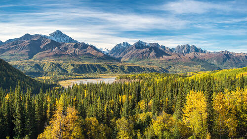
Seward Highway - Alaska
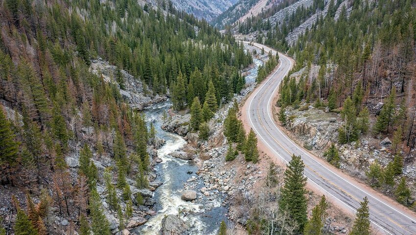
If you don’t already live in Alaska, you’ll need to fly to Anchorage and rent a car, but it’s worth the effort for the chance to travel the 127-mile stretch of Seward Highway. Running between the state’s largest city and the small town of Seward, it takes about 2.5 hours to cover the route without stopping, but you’ll want to take advantage of the many photo ops throughout the journey.
One of the most spectacular coastal roadways, Seward Highway winds through the Chugach National Forest bringing views of dramatic mountain peaks along with cascading waterfalls, sparkling lakes, and glistening glaciers. Watch for the region’s abundant wildlife, including bald eagles and moose. The unspoiled wilderness of the Kenai Fjords is waiting to be explored just a few miles before Seward where dazzling Resurrection Bay comes into view. The sapphire waters are frequented by everything from orcas and humpback whales to sea lions, otters, and harbor seals.
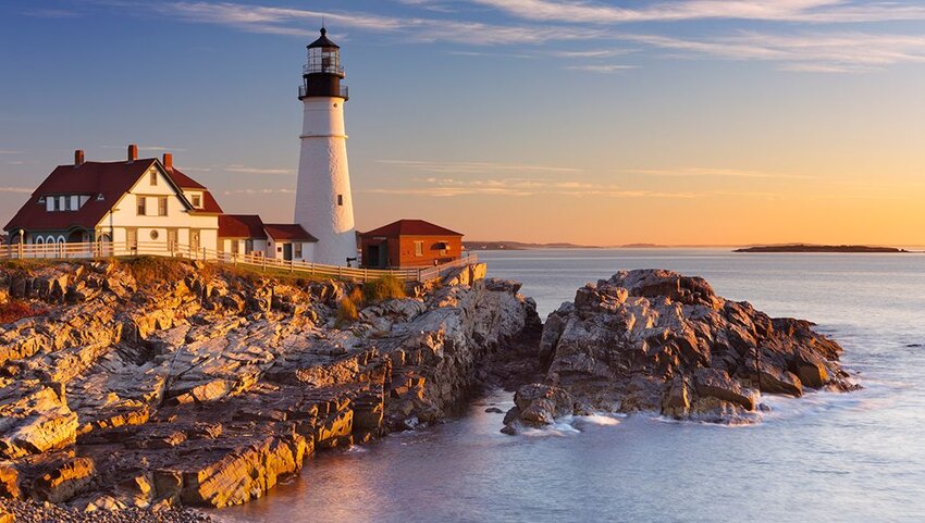
Coastal Maine's Route 1 - Maine
If you’re looking for magnificent coastal scenery and delicious lobster, this 159-mile drive offers both in spades. Follow Route 1 from Portland, stopping in Rockland which sits at the midway point. In this fishing village, rolling mountains meet the ocean, exemplifying the state’s slogan: “The Way Life Should Be.” It’s the perfect place for a break and you can post up at one of the many local coffee shops where espresso is made from micro-lot beans and ocean-view eateries with menus focused on Maine’s bounty of fresh seafood.
Just 10 miles further north is picturesque Camden, the “jewel of the Maine coast” with a postcard-perfect harbor where you can relax and watch the sailboats cruise across the bay. Or, take a stroll through the High Street Historic District with galleries and boutiques housed in classic New England architecture. There’s plenty to enjoy once you reach Acadia National Park with surreal beauty that includes lighthouses, beaches, and hiking paths that meander through untouched forest. If you’re up for a bigger challenge, hike to the summit of Cadillac Mountain for a bird’s-eye view of it all.
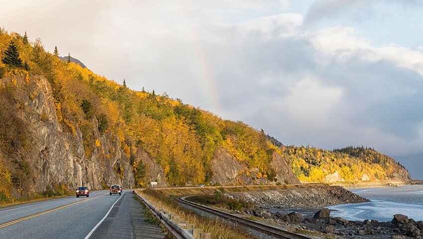
Columbia River Highway - Oregon
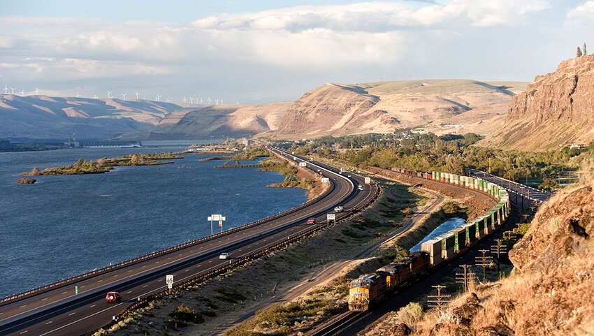
Oregon’s Columbia River Highway spans 75 miles from Troutdale, 16 miles east of Portland, to The Dalles. It follows the Columbia River which divides Washington and Oregon and was the first paved road in the Pacific Northwest. It was also the first of its kind to be officially declared a National Historic Landmark. Less than 10 miles in you’ll take a roller coaster of a descent, dropping 600 feet toward the Columbia River at Crown Point. It was specifically designed for road trippers, revealing a stunning panoramic view of the river.
The highway is best known for its many accessible waterfalls, including the world-famous Multnomah Falls, the most photographed in the state which tumbles 620 feet into a pool below all year long. Latourell Falls can be glimpsed from the road, but a short walk will bring you to a clear viewpoint of the 249-foot-high cascades.
Cache la Poudre-North Park Scenic Byway - Colorado
Cache la Poudre River is the only nationally designated Wild and Scenic River. It flows right through the city of Fort Collins in Northern Colorado and into the rugged Poudre Canyon. The stretch along the Cache la Poudre-North Park Scenic Byway is the most stunning. It’s framed by unusual rock formations and precipitous cliffs dotted with aspen, pine, and mountain mahogany.
On the journey to the tiny town of Rustic, just 41 miles from Fort Collins, you’ll find nearly endless opportunities for outdoor activities. That includes swimming holes for refreshing dips, whitewater rafting, fishing, and hiking. The wildlife is impressive too, with frequent sightings of deer often feeding in meadows and bighorn sheep navigating the boulders and rocky peaks.
Hocking Hills Scenic Byway - Ohio
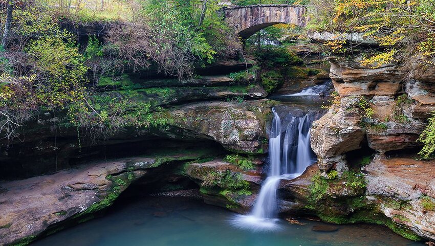
Hocking Hills Scenic Byway follows State Route 374 and provides some of the most impressive views in Ohio. The just over 26-mile roadway will bring you to historic sites and stunning natural wonders in Hocking Hills State Park. Traveling north to south from Rockbridge, the byway was built to connect six of the top spots in the park: Cantwell Cliffs, Conkle’s Hollow, Rock House, Cedar Falls, Ash Cave, and Old Man’s Cave,
While the views are breathtaking in every season, brilliant foliage takes the scenery to a new level in the autumn. Enjoy a leisurely day with stops at waterfalls and wildflowers, or opt for a more epic trek along one of many hiking trails. The Lower Gorge Trail in Conkles Hollow State Nature Preserve at around mile 18.5 is just a half-mile-long. It’s filled with ferns and colorful wildflowers like Virginia bluebells that are dotted along the stream that runs the trail’s length. The 2.5-mile Rim Trail ascends 200 feet providing an awe-inspiring view of the gorge from above the valley floor.
Beartooth Highway - Wyoming/Montana
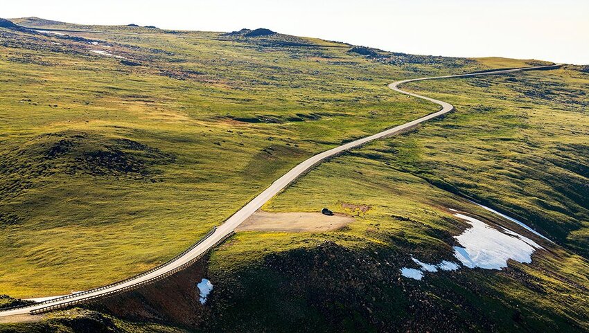
The 67-mile stretch of Highway 212 traveling through Wyoming and Montana is known as Beartooth Highway. A National Scenic Byways All-American Road, it’s the highest elevation highway in the Northern Rockies. It’s not for the faint of heart, with lots of tight hairpin turns, cresting at nearly 11,000 feet in elevation. The viewpoint at the summit is aptly named, “Top of the World.” From here you’ll be gazing out at the Beartooth and Absaroka Mountains, forested valleys, and glacial lakes. Keep an eye out for the wildlife that inhabits this remote area, including bighorn sheep, bobcats, mountain lions, and moose.